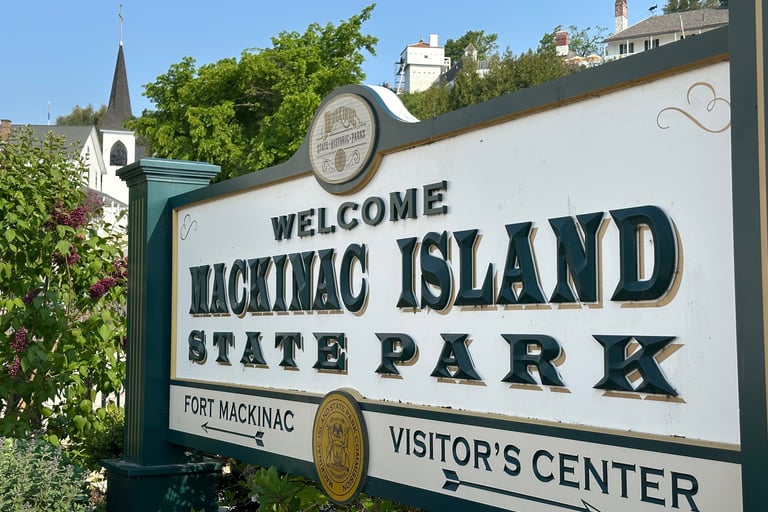
Mackinac Island in 5 Hours 30 Minutes
TRIP REPORTSHORT TRIP
Matthew Wietstock
9/14/202516 min read
Location Highlights
Location: Mackinac Island, Michigan, United States
Population (Island): 867
Known for: Mackinac Island State Park, motor vehicles ban, extensive 15-19th century architecture, Hole in the Rock
Weather during visit: Sunny, 6 - 27º C (43 - 80 ºF)
Time in Place: 5 hours 30 minutes
Mackinac Island is an island not lost to time but made from it, and preserving it. Famous for being a prime summer destination lacking motor vehicles but not in fudge, Mackinac has drawn visitors from all over the world to experience the natural beauty and historical sites on the small 11.3 km2 (4.35 mi2) island. Its unique position in the middle of the Great Lakes region, stretched between two of the lakes, two halves of the state, and even two countries, has led it to a nearly unrivaled history stretching back to and even beyond the earliest European settlers in the Midwest.
My family has a lengthy history with Mackinac Island, but this trip was my first time getting to explore the place I had heard so many stories about. From the moment I stepped foot off the ferry, I knew it was someplace special, and there were so many things that just emphasized that point. Despite its small size, there is no shortage of activities on Mackinac, and there were plenty of things throughout the day I would have enjoyed getting to experience deeper, but I did walk (or sail) away from the island feeling like I had a relatively thorough first visit that allowed me to appreciate the community that calls the middle of the Great Lakes home.
Arriving at Mackinac Island
Getting to Mackinac Island
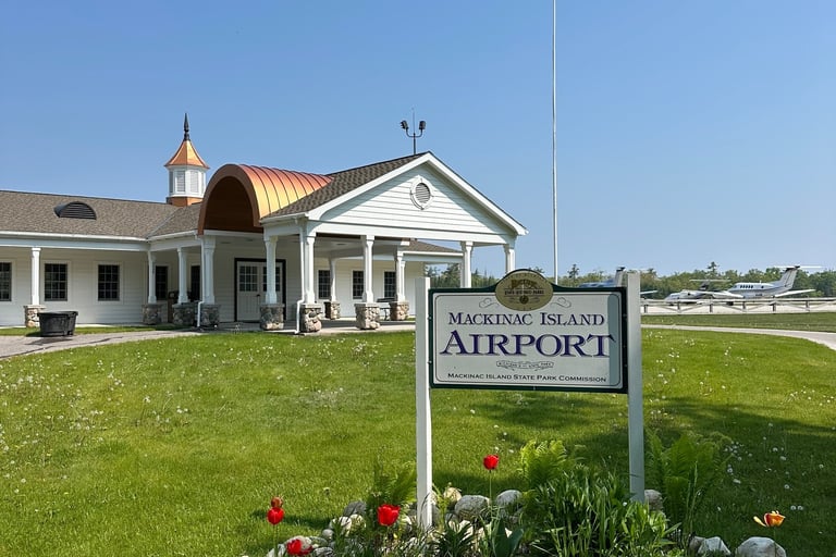
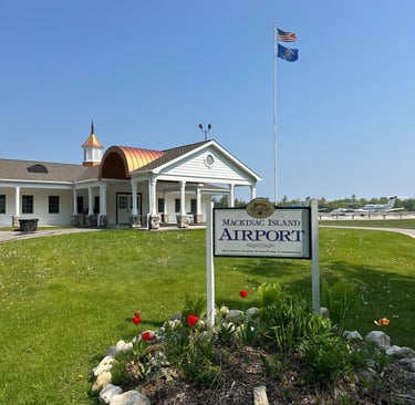
There are two ways to get to Mackinac Island: by sea or by air. The island is home to a small, single-runway airport capable of landing prop aircraft and the smallest business jets. While there is no fuel service on the island, the state park run airport has decent facilities like a pilot lounge and covered cul-de-sac for boarding horsedrawn taxis to town or the island’s various resorts. Landing fees are very reasonable at $15 per landing and $15 per night for tiedowns on a single-engine piston aircraft. The airport is also incredibly important for locals as it is the only way for people and goods to reach the island once Lake Huron ices over.
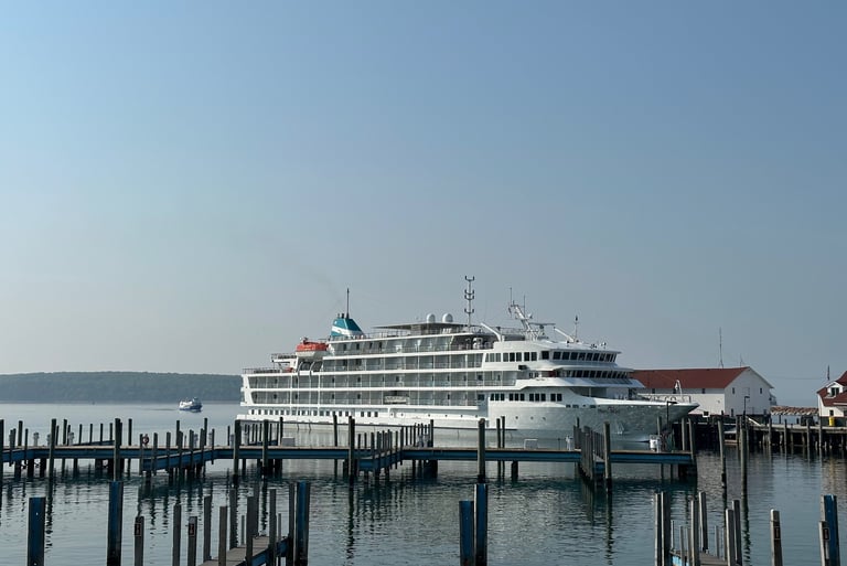
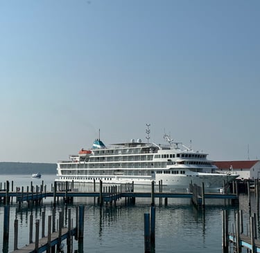
The other option when visiting the island, and the more common option in the summer, is the ferry. The ferry service typically operates from late April through late October both from Mackinaw City on the Lower Peninsula and St. Ignace on the Upper Peninsula. A roundtrip ferry ride for adults in 2025 costs $38 with additional charges for bikes and parking. One unique feature of the ferry service is the availability to check luggage onboard which may be delivered directly to your hotel if staying at certain properties like the Grand Hotel or other partnered resorts. As an important lifeline for the community, there are resident and work commuter passes available, which also include benefits like priority boarding, but they are specifically reserved for those working and living on the island.
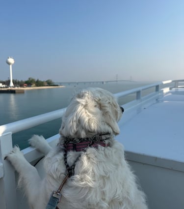
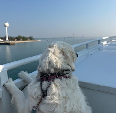
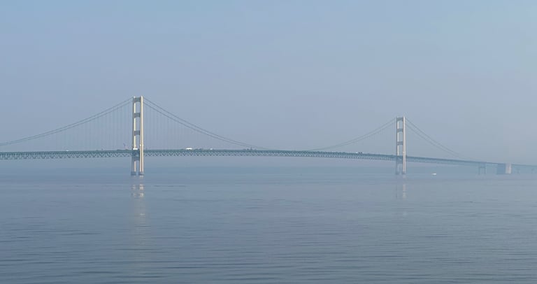
Even with some significant wildfire smoke streaming in from Ontario and causing haze around the lake, the ride to the island was incredibly scenic. Mackinac Bridge rose triumphantly into the smokey sky while the island appeared before us slowly, a phantom of the lake. As we got closer to the island, we began to recognize some of the island’s landmarks. Large structures like the Grand Hotel appearing along the bluffs and the Rock Island Lighthouse guiding us into port. Around 15 minutes after departing the mainland, we had arrived at the island.
Getting Around Mackinac
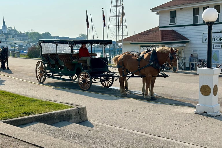
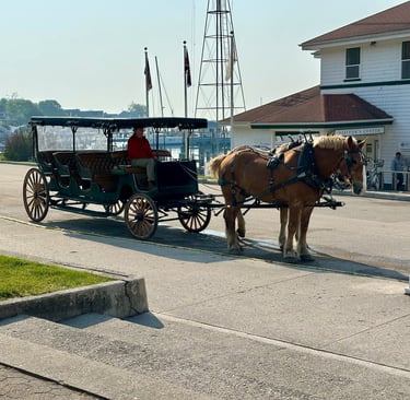
One of the most important facts about Mackinac Island is that there are no motor vehicles allowed on the island except for the town’s fire engine and ambulance. This means the only way to get around is by foot, by snow machine (in the winter), by horse and carriage, and by bike, with the latter being the most popular. There are taxis of horse-drawn carriages to take visitors around the island where they need to go, and most tourist locations on the island have the ability to call for a taxi. There are also carriage tours around the island with stops at some of the most famous landmarks.
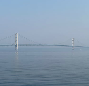
Like the vast majority of tourists arriving on Mackinac Island, I arrived via ferry. After parking at the general lot and taking the quick shuttle ride (under 5 minutes) to the terminal building, I was able to wait along the dock for the next departure. The dock facilities are fairly nice and have a restroom, ticket booth, and luggage check without much else in the way of amenities. The terminal is across the street from downtown Mackinaw City, however, with other shops and restaurants available there. The ferries typically leave from the mainland every half hour or so during the peak season, and we boarded the vessel around 8:15 a.m. after a fresh arrival from the island for the 8:30 a.m. departure. Some trips take a detour to get an up-close view of the Mackinac Bridge, though I chose to take a standard departure over. For those wanting to get up close without the special trip, I would recommend visiting Fort Michilimackinac State Park at the bridge base.
While the others in my group brought their bikes on the ferry, I was travelling from further afield and could not bring my trusty Trek with me. It is possible to rent on the mainland and bring it on the ferry, but this is usually nearly as expensive as renting on the island, so I would only recommend this if you are planning to bike for several days including off the island. Still, renting on the island itself is not cheap. I ended up paying $94 for a full-day rental from Mackinac Cycle, located quite conveniently at the end of the Arnold Dock where Shepler’s docks. The Trek Verve multispeed step-through was in good working condition and came with a hitch (important for later in the day, though we didn’t know it at the time), a helmet (I brought my own), a map of the island, and a bottle of water.
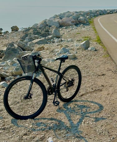
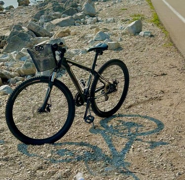
Without cars on the island, it is incredibly safe and easy to get around by bike. The worst part is getting stuck behind a carriage tour on the narrow roads, though for those looking for an easy ride without too much hassle, I would recommend Michigan State Highway M-185, which encircles the island. M-185 is the only state highway in the United States where motor vehicles are prohibited. This just under 13 km (8 mi) loop takes visitors to many of the island’s most famous tourist spots like Arch Rock, British Landing, and the Grand Hotel. We were planning to bike the full loop, but first wanted to see a few spots in town.
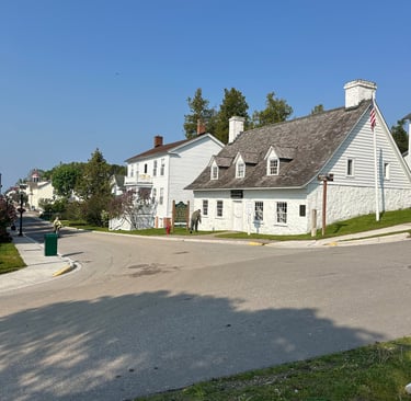
Downtown Mackinac
One of the first things I noticed about being on the island was just how quiet it was despite being in the heart of busy season. By quiet I don’t mean there were not lots of people around; the island itself was packed the week after Memorial Day, but my ears never felt strained like they often do in cities. It was an excellent reminder how cities themselves are not loud, but cars and motor vehicles are.
The second thing I noticed was how well adapted the city felt for its chosen path. People were doing their jobs perfectly fine without cars; there was a carriage for garbage, porters for various hotels stacking luggage onto bikes and bike trailers, and people jumping onto the backs of goods carriages for a quick trip up the steep hills. The only difference from a regular city, other than the obvious, was the significant increase in the number of sanitation workers out making sure the streets were clean due to the horses.
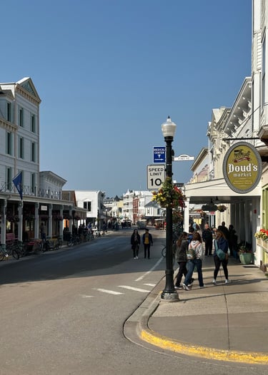
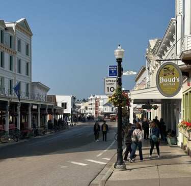
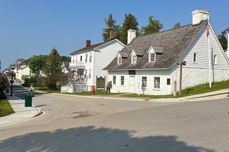
While many of the buildings around the island are kept in historic form with wooden siding and covered boardwalks, they still had all the modern amenities one would expect like electricity, air conditioning, and Wi-Fi. Some of the cabbies were dressed as if they were from the 1800s, but there were plenty of other workers and residents dressed just like other Michiganders on the mainlands. This is a good time to bring up the fact that Mackinac Island is not just a tourist destination but an actual city as well, home to a year-round population with nearly all the same conveniences as those in Mackinaw City or St. Ignace. The only difference here is your Amazon packages arrive by horse instead of truck. There is a school district on the island, a post office, a grocery store (the oldest operating grocery in the US) ,and a city government which is currently home to the longest continuously serving mayor in the United States.
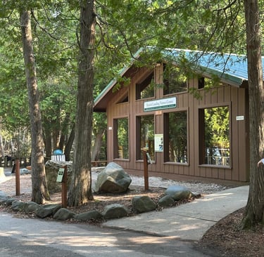
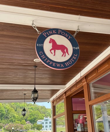
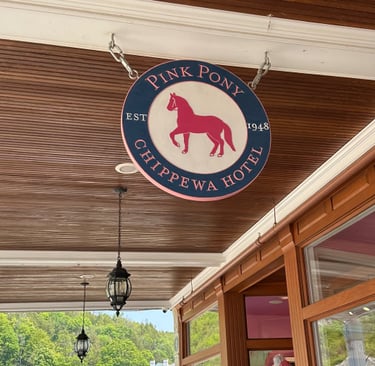
Where M-185 runs through town, it is called Main Street, and along each of its sides through the heart of downtown lies the typical tourist shops that have come to be known on the island, such as the booming Mackinac Island fudge industry and the Pink Pony Club Bar and Restaurant. Standard tourist fare is expected, with the classic T-shirt and postcard shops available plus some brand-name shops like Vineyard Vines (I suppose it was expected given this is the Midwest’s Martha’s Vineyard). On the south end of Main Street is the public library and Biddle’s Point, one of the largest (and probably sandiest) beaches on the island. On the north end is the beginning of Mackinac Island State Park, the large park which encompasses 80% of the island’s land and records its history across millennia.
Turning east out of the downtown area is Mission Point, home to one of the most impressive churches with Ste. Anne (note the French spelling) and the second largest resort on the island with Mission Point Resort. Mission Point also has a large lawn overlooking Lake Huron and Round Island. And there’s mini-golf! After a few more small BNB’s and houses, M-185 turns north and becomes Lake Shore Drive.
An Island Floating in the Void
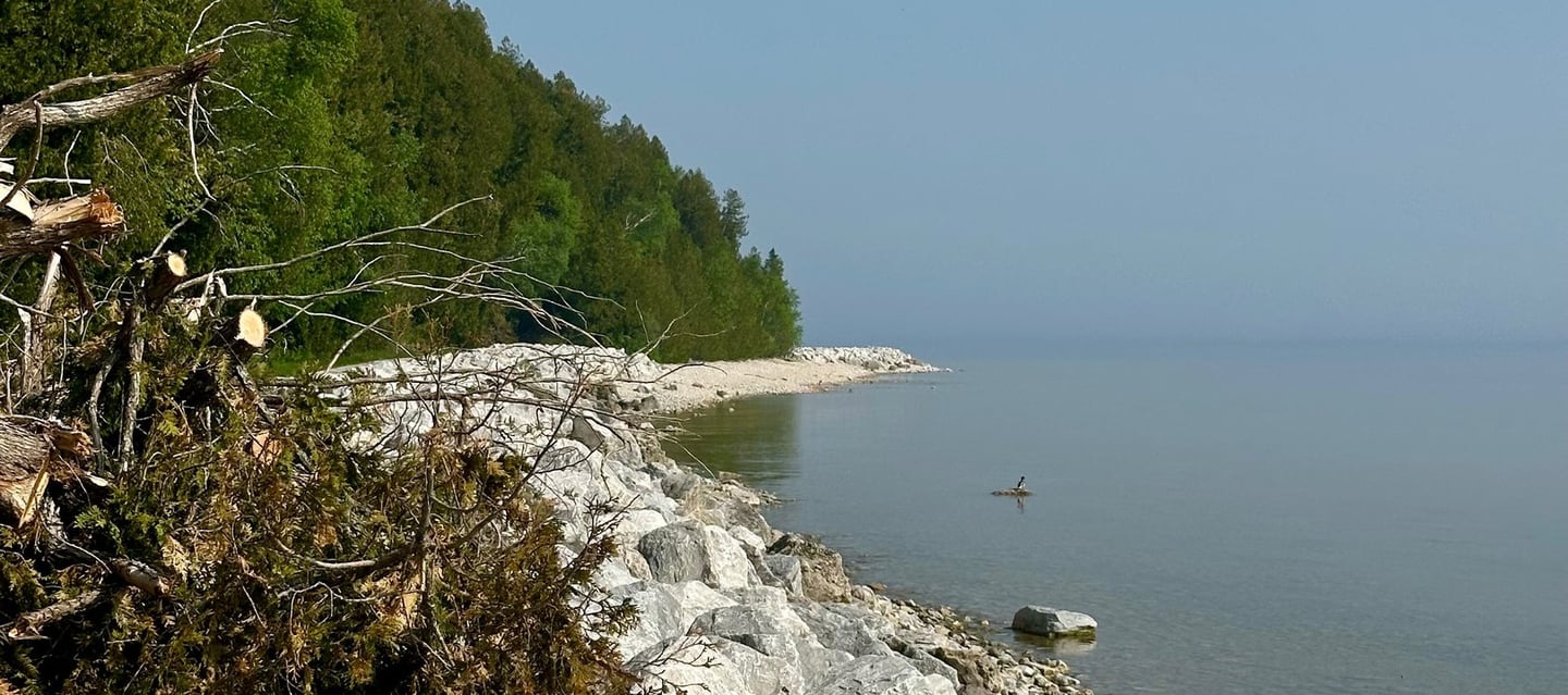
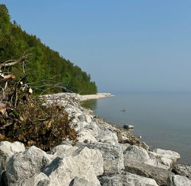
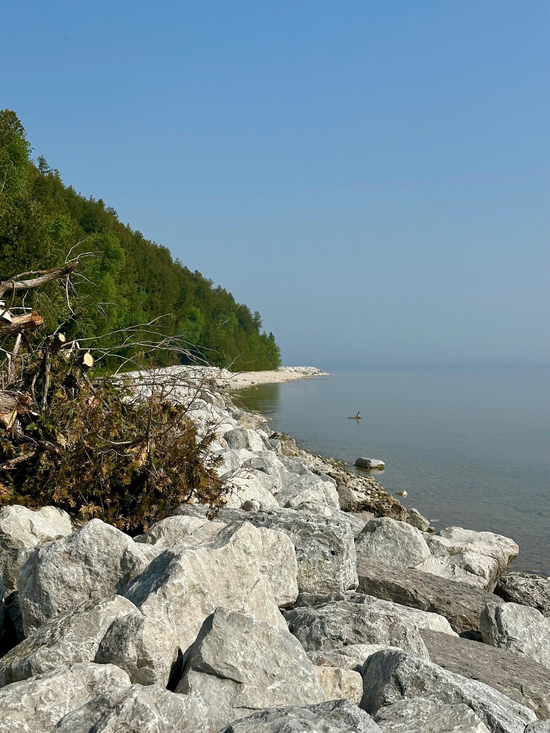
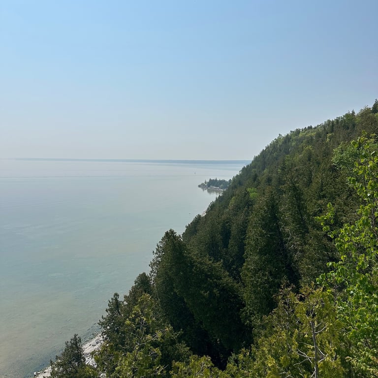
If I had to choose one word to describe the ride around Mackinac Island during our visit, especially along the Eastern shore, it would be ethereal. I had previously mentioned in this report that wildfire smoke from Canada was greatly reducing the visibility in the region, but when you are on an island and the nearest land to the side of the island you are on is over 15 km (10 mi) away, there is nothing to break up the haze. The island itself seemed to be floating in a void, no horizon to show where the lake ended and the sky began. The weather didn’t help either as it was calm winds and a clear sky, the temperatures cool yet comfortable. Overall, excellent conditions for a bike ride, and I was perhaps the most relaxed I had been in months on that ride.

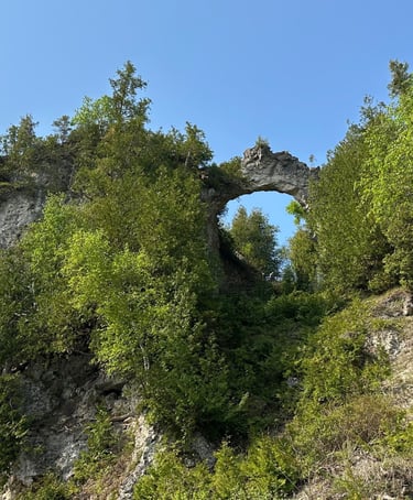
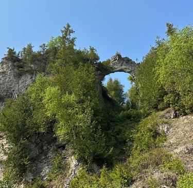
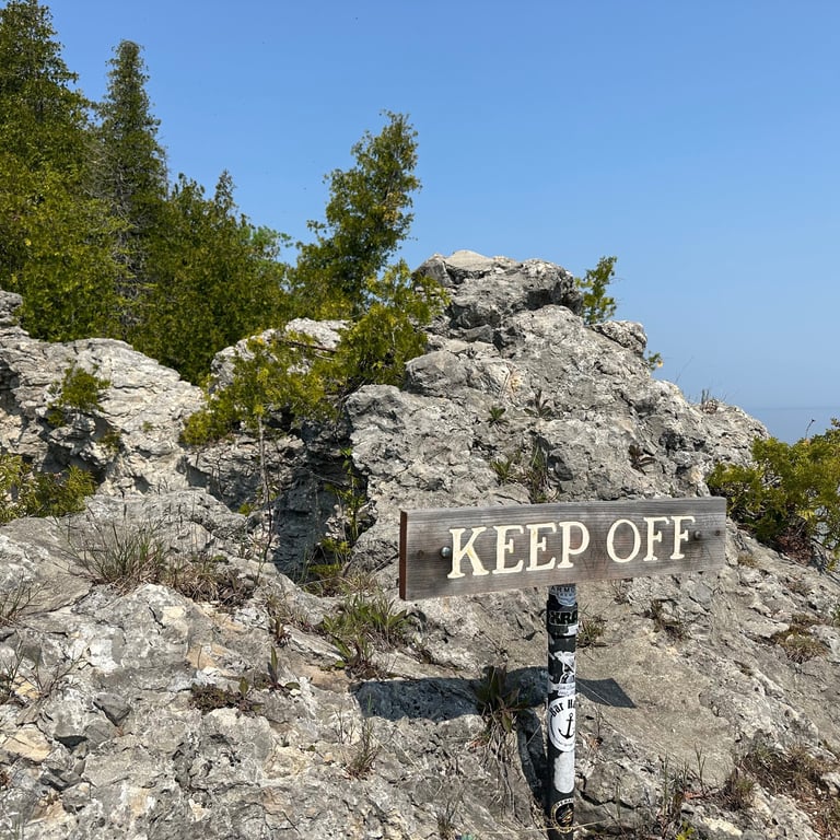
Fairly soon out of town you come upon Arch Rock, one of the most famous natural icons not just for Mackinac Island but for the state of Michigan too. While you can get great views of Arch Rock from below, especially when framed against a clear blue sky, the best views come from the top, which we visited later. The most common way to get there is via the various roads and trails from the west side of the island, but for those determined enough, there is a set of stairs leading up to the top from the lakeshore; just be prepared for a long hike and a serious leg workout. The highway does have several pullouts in the area to allow visitors to get out of the way of oncoming traffic while snapping photos and enjoying the views.
Continuing along the east shore, it is a very easy ride, giving cyclists the chance to savour the views along the way. It is incredibly flat, not just along this section but for nearly the entire length of M-185. Looking on a map, one might think that the trail is fairly straight, but it is curvier than expected with miniature boys and points trading places. 13 km (8 mi) may sound intimidating for some, especially inexperienced cyclists, but it is not a race around the island, and the ride is not technical; take your time, enjoy the views, and you will be perfectly fine even if you have not done a longer distance bike ride.
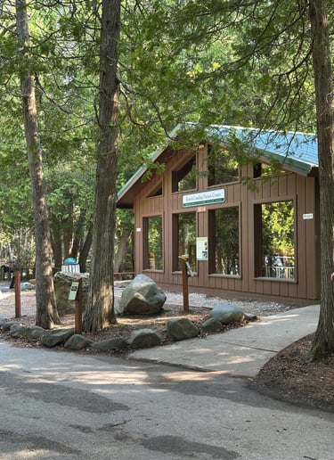
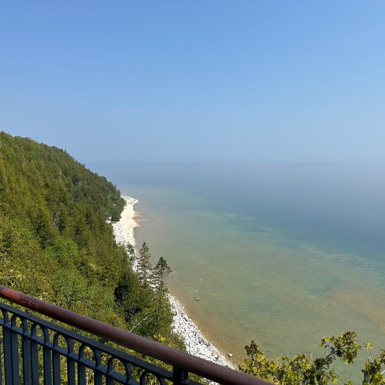
There are not many properties, or honestly, much of anything at all man-made along this stretch of highway between leaving Mission Point and Point aux Pins on the northernmost tip of the island. Even at this point of the island, there are just a few scattered residential properties without much in the way of public access. If you need any services, you’ll need to continue further south after rounding Point aux Pins to reach British Landing, the site of, you guessed it, the British (and allied Native American tribes) during the War of 1812. At British Landing, there is an education center (closed during our visit), public restrooms, a pebble beach overlooking Mackinac Bridge, and the Cannonball, a quick service restaurant that I can best describe as “snack shack” food. British Landing also serves as a major junction along M-185 with British Landing Road, the road we would take to reach the island’s interior.
Climbing Mackinac
We climbed up British Landing Road to the center of the island where it connects with several of the island’s other roads just past the airport. Along the way were some of the largest hills cyclists and hikers will need to navigate to reach famous spots on the interior, like Wawashkampo Golf Club. While we were ultimately headed towards the Eastern portion of the island’s interior, we made a quick detour at Annex Road to visit the airport. While we were there we got to see a Cessna 421 arrive and a park ranger greet them while a taxi waited out front.
After getting back to the intersection we continued along Garrison Road, the main thoroughfare through the heart of the island. Some of the main sites along this stretch include the two cemeteries sitting on opposite sides of the road, one side Catholic and one side Protestant, and Skull Cave, a small cave used by Native Americans as a burial site through the 1800’s. Just past Skull Cave is Rifle Range Road which cuts due east across the former fort’s rifle range to reach Arch Rock.
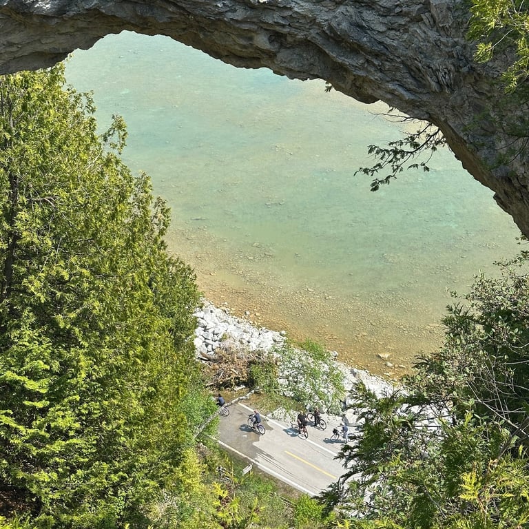
Arch Rock is one of the most famous and popular sites within Mackinac, and it’s even better from the top. The formation is impressive, and the view of the lake below is stunning. Looking down from the overlook, you can easily see the cyclists and hikers below on M-185, offering a unique photo opportunity for those who have that level of coordination and prior planning. Up a small staircase on the right side of the formation is another viewing platform, giving visitors the chance to see the arch from above as if they were climbing atop it (do not actually try to climb on top of it!). This is also one of the best vantage points on the island, and you can see for miles across Lake Huron. One of the most impressive things about Lake Michigan and Lake Huron, especially this far north, is how clear the water is. It feels like the Caribbean at times, with visibility into the lake extending impressively far. From our point at Arch Rock, we were still able to see the rocky lakebed for a decent way from shore. The haze started lifting a bit by this point too, allowing for glimpses to the other islands nearby like Bois Blanc to the south or Goose Island and Marquette Island to the east in Ontario.
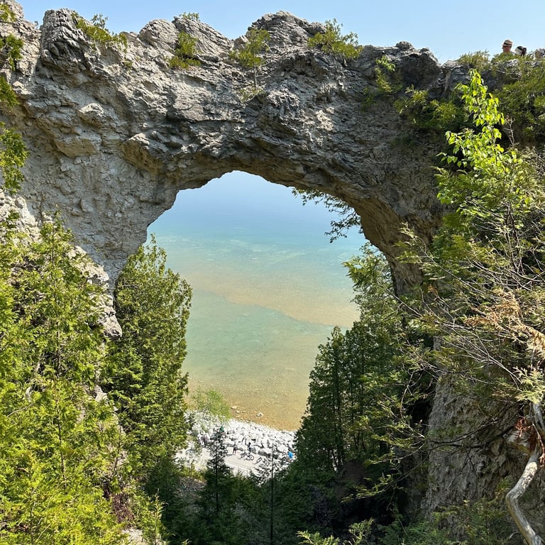
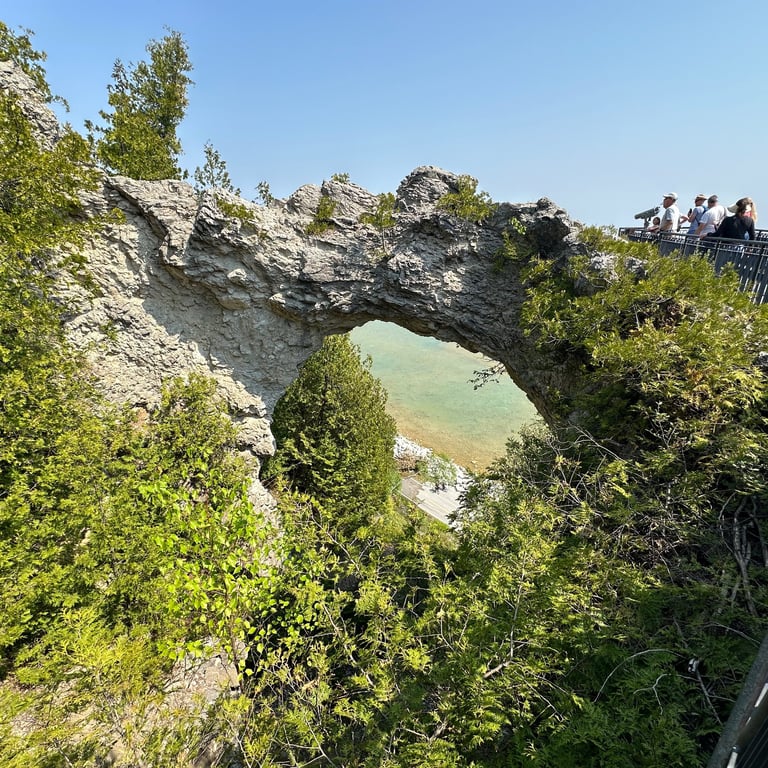
A new batch of tourists would arrive and another leave every 7 minutes as wagons for the island carriage tours arrived on a set schedule in the Arch’s circle drive. Also located in the area is the Milliken Nature Center, a new-for-2024 building that hosts nice amenities like clean restrooms and a water fountain along with an exhibit on how Arch Rock was geologically formed over centuries. And, of course, there are plenty of bike racks around to ensure that the island’s many cyclists have a proper place to lock up their bikes while enjoying the overlook or nature center.
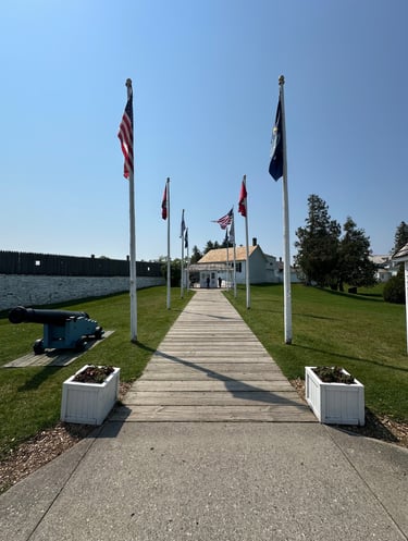
The next stop was located down Arch Rock Road, Fort Mackinac, one of the original European settlements on the island. It would be irresponsible to call the structures by European settlers as the original settlements, as the island has played host as an important meeting point for the Native American and First Nations tribes of the region, including the Anishinaabe peoples of the Odawa, Ojibwe, Potawatomi, and Algonquin tribes. The name “Mackinac” is a British term shortened from the Gallicized (“Frenchified”) Michillimackinac from the mishimikinaak in Ojibwe (ᒥᔑᒥᑭᓈᒃ in Ojibwe syllabics), meaning “big turtle” as that was what the tribes believed the island resembled. An important meeting point between the tribes, it is also believed by the Anishinaabe tribes to be the home of Gitche Manitou, the Great Spirit.
The fort (one of two on the island) was developed by the British at a former trading post in 1782 to assert their territorial claim and control the Great Lakes trade during the American Revolution. It was so important to the British, in fact, that it was not ceded to the Americans until thirteen years after the Revolutionary War was over, just in time for the War of 1812 to commence. The British were able to reclaim control of the fort for the duration of the conflict, during which there were two battles on the island. It was during the War of 1812 that Fort George was constructed at the highest point on the island to assert British control over the straits. After the war, the fort was used by the US Army for 60 years, including briefly as a prison for political prisoners during the American Civil War. The island was briefly the United States’ second national park from 1875 to 1895 before being transferred to the state of Michigan as its first state park.
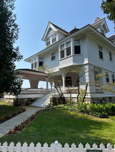
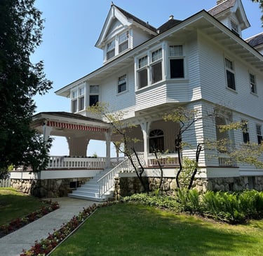
Today, Fort Mackinac acts as a history museum for the island and still offers reenactments of military activities, such as displays on the parade grounds. Located across from the main fort is the Scout Barracks, where troops of scouts from Scouting America and the Girl Scouts can work on the island for a week during the summer season, raising and lowering the 27 American flags around the island, completing service projects, and functioning as island guides for visitors. Also across from the fort is one of the main stables for the island’s carriage operators. At the far end of Huron Road, where it T’s with Fort Street, is the Michigan Governor’s Summer Residence, the historic home of a Chicago attorney constructed in 1901. The residence (the only seasonal residence of a US governor) has hosted US presidents, foreign dignitaries, and has seen significant use by some Michigan governors.
Connecting the Loop
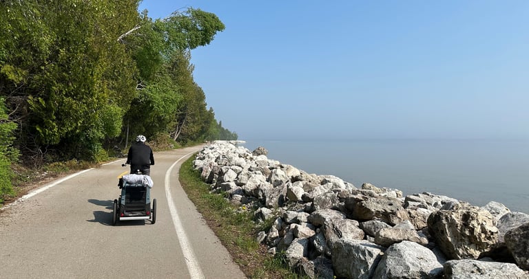
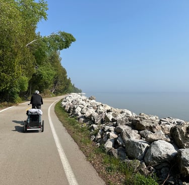
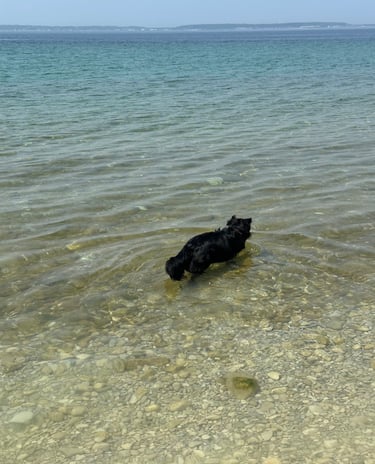
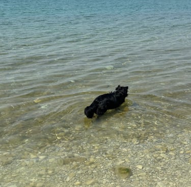
We did not want to pay the admission fee for the fort (also, we were traveling with dogs, and they are not allowed in the fort), and the Governor’s Mansion is not open for tours, so we headed back up Garrison Road to the airport and then back to British Landing. Enjoying the warmth of the sun on the now clear day, we let the dogs play in the clear lake waters for a while before continuing down M-185. About a mile down the road from British Landing and still another mile from town, disaster struck: a group member’s (non-rented) bike pedal broke off from the crank. This was especially problematic as they were pulling a trailer containing the bigger of the two dogs.
About 30 minutes of trying, and failing, to fix it led to another period of trying, and again failing, to jerryrig a solution. Finally, a stroke of good luck as we discovered my rental bike had the same hitch that the dog trailer used, meaning I was now responsible for pulling the 30 kg (70 lbs) dog the rest of the way around the island. The trail was mercifully still very flat at this point, and once you were moving it was not terribly difficult to pull. From this point on, the focus was simply on making it back to town and getting everything sorted from there.
The rest of the trail included better views of the mainland (especially with the haze lifting) and some of the other sites around the island. One of these was the previously mentioned Grand Hotel, an active Victorian-era hotel that not only looks fancy but acts it too. I would love to see it sometime, but non-guest visitors have to pay a $12 entry fee, and there is a strictly enforced dress code. A little further past the hotel is the Mackinac Island Public School building, home of the Mackinac Island Lakers. This is also the point where M-185 turns into Main Street again, and the roads become lined with year-round houses instead of just summer cottages.
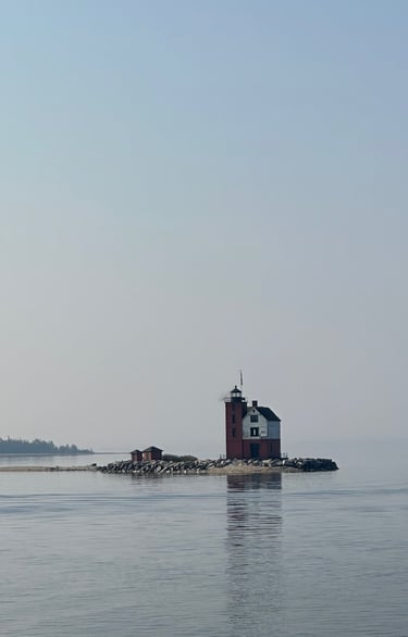
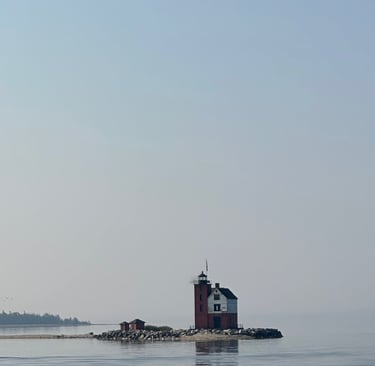
Back in town, it had gotten even busier than it was when we were in earlier, the sidewalks crowded with pedestrians and the streets clogged with bikes and carriages alike. While we waited for the last member of our group to walk their bike back to town, we tended to the dogs and returned my rental bike, window shopping along the way at the various shops but not purchasing anything. Once reunited, we were able to quickly catch another ferry back to the mainland without too much of a wait. Just be careful to get in the correct line at the pier; otherwise, you’ll take an unexpected trip to St. Ignace. The ride back was just as smooth as the way out, exceedingly tranquil while enjoying views of the Round Island Lighthouse, the island’s bluffs, and Mighty Mac.
I simply adored my time on Mackinac Island, and I can understand how it has gotten so popular over the years. It is hard to describe the island fully to those who have not visited it or Northern Michigan before, but this area of the country is so unique to what you find almost anywhere else. Beautiful sandy beaches lining the freshwater shores, a rich history dating back beyond the founding of this nation, and a peaceful yet vibrant village seemingly plucked from the past where you don’t have to worry about motor vehicles (do watch out for bikes though). It can be a bit difficult to get to, but it is 100% worth it to visit Mackinac Island, and I not only recommend everyone visit but have plans to visit again myself fairly soon, a relative rarity in my travels to make a repeat visit so quickly.